
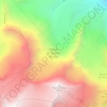
Tsijiore-Nouve-Gletscher topographic map
Interactive map
Click on the map to display elevation.
About this map
Name: Tsijiore-Nouve-Gletscher topographic map, elevation, terrain.
Average elevation: 3,042 m
Minimum elevation: 2,168 m
Maximum elevation: 3,777 m
Other topographic maps
Click on a map to view its topography, its elevation and its terrain.
Mont-Miné-Gletscher
Mont-Miné-Gletscher, Arolla - Cabane de la Tsa, Tsijiore Nouve, Evolène, Ering, Wallis, 1983, Schweiz
Average elevation: 3,006 m