Geolocate

Appachimedu topographic map

Click on the map to display elevation.

About this map

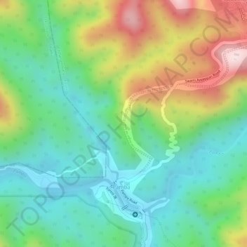
Name: Appachimedu topographic map, elevation, terrain.

Location: Appachimedu, Pamba, Konni, Pathanamthitta, Kerala, India (9.41304 77.05788 9.43304 77.07788)

Average elevation: 301 m

Minimum elevation: 157 m

Maximum elevation: 549 m

Gear up for your next adventure:

🧴Tick Removal Tools - Small, essential health tool for UK woodland and moorland
🔋Lithium AA Batteries - Long-lasting power that performs well in cold mountain weather
🚲Bikepacking Frame Bags - Storage for tools and navigation gear on long off-road rides
🧥Waterproof Hiking Jackets - Rain protection for walking in all weather conditions
👟Men's Trail Running Shoes - Lightweight grip for fast movement over topographic contours

As an Amazon Associate, this site earns from qualifying purchases at no extra cost to you.