
Kostinbrod topographic map
Interactive map
Click on the map to display elevation.
About this map
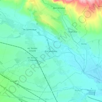
Name: Kostinbrod topographic map, elevation, terrain.
Location: Kostinbrod, Sofia, 2230, Bulgaria (42.77320 23.17565 42.85320 23.25565)
Average elevation: 557 m
Minimum elevation: 520 m
Maximum elevation: 703 m
Other topographic maps
Click on a map to view its topography, its elevation and its terrain.