
Wolfhaag topographic map
Interactive map
Click on the map to display elevation.
About this map
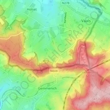
Name: Wolfhaag topographic map, elevation, terrain.
Location: Wolfhaag, Vaals, Limburg, Nederland, 6291 NB, Nederland (50.73852 5.98127 50.77852 6.02127)
Average elevation: 237 m
Minimum elevation: 156 m
Maximum elevation: 345 m
Other topographic maps
Click on a map to view its topography, its elevation and its terrain.
Hoogste Punt van Nederland
Hoogste Punt van Nederland, Vaals, Limburg, Nederland, 6291 BX, Nederland
Average elevation: 272 m
Kasteel Vaalsbroek
Kasteel Vaalsbroek, Vaalsbroek, Vaals, Limburg, Nederland, 6291NH, Nederland
Average elevation: 219 m