
Hardenberg topographic map
Interactive map
Click on the map to display elevation.
About this map
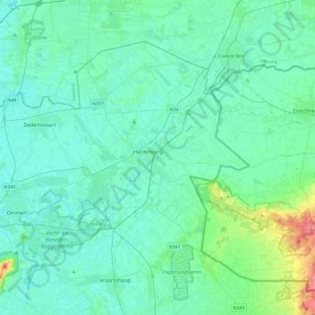
Name: Hardenberg topographic map, elevation, terrain.
Location: Hardenberg, Overijssel, Niederlande (52.46560 6.30306 52.67405 6.76669)
Average elevation: 13 m
Minimum elevation: 2 m
Maximum elevation: 73 m