
La Serra topographic map
Interactive map
Click on the map to display elevation.
About this map
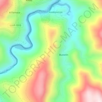
Name: La Serra topographic map, elevation, terrain.
Location: La Serra, Ibias, Astúrias, 33810, Espanha (43.05692 -6.95358 43.07692 -6.93358)
Average elevation: 429 m
Minimum elevation: 211 m
Maximum elevation: 757 m
Other topographic maps
Click on a map to view its topography, its elevation and its terrain.