Geolocate

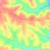
Dawt topographic map

Click on the map to display elevation.

About this map

Name: Dawt topographic map, elevation, terrain.

Location: Dawt, Ozark County, Missouri, 65760, United States (36.59006 -92.29683 36.63006 -92.25683)

Average elevation: 219 m

Minimum elevation: 168 m

Maximum elevation: 281 m

Other topographic maps

Click on a map to view its topography, its elevation and its terrain.
Bakersfield

United States > Missouri > Ozark County

Average elevation: 244 m

Theodosia

United States > Missouri > Ozark County

Average elevation: 249 m

Gainesville

United States > Missouri > Ozark County

Average elevation: 280 m

Gainesville

United States > Missouri > Ozark County

Average elevation: 280 m

Gear up for your next adventure:

🧴Tick Removal Tools - Small, essential health tool for UK woodland and moorland
🔥Reusable Hand Warmers - Maintain dexterity in your fingers for precise map handling
📱Phone Mounts for Hiking - Secure mounts to carry your phone on trails
🗺️Ordnance Survey Maps - Official UK maps for walking and outdoor activities
🎒Replacement Sternum Straps - Repair parts for hiking rucksacks

As an Amazon Associate, this site earns from qualifying purchases at no extra cost to you.