
Make a donation
Gear up for your next adventure:
As an Amazon Associate, this site earns from qualifying purchases at no extra cost to you.
Ludham topographic map
Click on the map to display elevation.
Make a donation
Gear up for your next adventure:
As an Amazon Associate, this site earns from qualifying purchases at no extra cost to you.
About this map
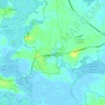
Name: Ludham topographic map, elevation, terrain.
Location: Ludham, North Norfolk, Norfolk, England, United Kingdom (52.69437 1.49456 52.72755 1.57352)
Average elevation: 3 m
Minimum elevation: -4 m
Maximum elevation: 16 m
Norfolk trails, hiking, mountain biking, running and outdoor activities
Make a donation
Gear up for your next adventure:
As an Amazon Associate, this site earns from qualifying purchases at no extra cost to you.
Other topographic maps
Click on a map to view its topography, its elevation and its terrain.
Johnson Street
United Kingdom > England > Norfolk > North Norfolk > Ludham > Johnson Street
Average elevation: 3 m