
Le Thieulin topographic map
Interactive map
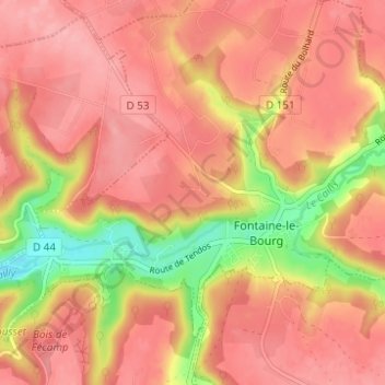
Click on the map to display elevation.
About this map
Name: Le Thieulin topographic map, elevation, terrain.
Average elevation: 138 m
Minimum elevation: 65 m
Maximum elevation: 171 m
Other topographic maps
Click on a map to view its topography, its elevation and its terrain.
La Justice
France > Normandie > Seine-Maritime > Fontaine-le-Bourg
La Justice, Fontaine-le-Bourg, Rouen, Seine-Maritime, Normandie, France métropolitaine, 76690, France
Average elevation: 140 m