
Úmonín topographic map
Interactive map
Click on the map to display elevation.
About this map
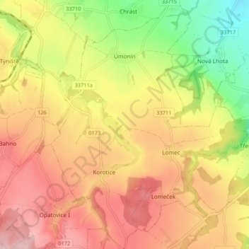
Name: Úmonín topographic map, elevation, terrain.
Location: Úmonín, okres Kutná Hora, Central Bohemia, 28546, Czechia (49.84789 15.23886 49.90030 15.31151)
Average elevation: 373 m
Minimum elevation: 272 m
Maximum elevation: 451 m