
Mooresville topographic map
Interactive map
Click on the map to display elevation.
About this map
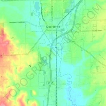
Name: Mooresville topographic map, elevation, terrain.
Location: Mooresville, Morgan County, Indiana, United States (39.55867 -86.39868 39.63104 -86.33559)
Average elevation: 223 m
Minimum elevation: 193 m
Maximum elevation: 285 m