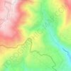
Qaa Er Rim topographic map
Click on the map to display elevation.
About this map

Name: Qaa Er Rim topographic map, elevation, terrain.
Location: Qaa Er Rim, Zahlé District, Beqaa Governorate, Lebanon (33.86332 35.85481 33.90332 35.89481)
Average elevation: 1,501 m
Minimum elevation: 1,033 m
Maximum elevation: 1,937 m
Other topographic maps
Click on a map to view its topography, its elevation and its terrain.

Fourzol
Ferzol (Levantine Arabic: الفرزل, romanized: il-Firzul), also spelled Forzol, Ferzul or Fourzol, is a village located in the Zahlé District of the Beqaa Governorate in Lebanon. It lies approximately six to eight kilometres north of Zahlé, the principal city of the Beqaa Valley, along the road toward…
Average elevation: 1,075 m


Shouf Cedar Biosphere Reserve Limit
Precipitation in the watershed is the source of both surface streamflow and groundwater. The major portion of this occurs as rain. Snowfall often occurs at the upper elevations but snow seldom persists more than a few days and disappears before the end of the rainy season. Normally snow has little overall…
Average elevation: 980 m