Geolocate

Adelong topographic map

Click on the map to display elevation.

About this map

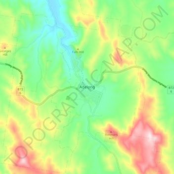
Name: Adelong topographic map, elevation, terrain.

Location: Adelong, Snowy Valleys Council, New South Wales, Australia (-35.34749 148.02315 -35.26749 148.10315)

Average elevation: 427 m

Minimum elevation: 258 m

Maximum elevation: 698 m

Gear up for your next adventure:

Insulated Travel Mugs - Keep drinks hot while surveying the landscape from a summit
🌄Compact Monoculars - Lightweight optics for hiking
📸Action Camera Chest Mounts - Record your ascent following topographic paths hands-free
🧰First Aid Kits - Essential safety kits for outdoor activities
🥾Men's Waterproof Hiking Boots - Durable footwear with deep lugs for muddy and rocky UK terrains

As an Amazon Associate, this site earns from qualifying purchases at no extra cost to you.