
Llangurig topographic map
Interactive map
Click on the map to display elevation.
About this map
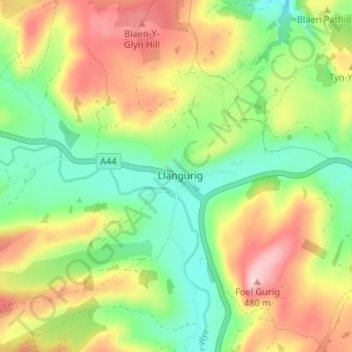
Name: Llangurig topographic map, elevation, terrain.
Location: Llangurig, Powys, Wales, SY18 6SG, United Kingdom (52.38647 -3.62631 52.42647 -3.58631)
Average elevation: 349 m
Minimum elevation: 251 m
Maximum elevation: 480 m