
Almaty topographic map
Click on the map to display elevation.
Almaty
Almaty continues as the major commercial and cultural centre of Kazakhstan, as well as its most populous and most cosmopolitan city. The city is located in the mountainous area of southern Kazakhstan near the border with Kyrgyzstan in the foothills of the Trans-Ili Alatau at an elevation of 700–900 m (2,300–3,000 feet), where the Large and Small Almatinka rivers run into the plain.
About this map
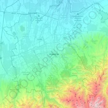
Name: Almaty topographic map, elevation, terrain.
Location: Almaty, Бостандыкский район, Almaty, 050013, Kazakhstan (43.07639 76.78573 43.39639 77.10573)
Average elevation: 1,261 m
Minimum elevation: 633 m
Maximum elevation: 4,319 m
Other topographic maps
Click on a map to view its topography, its elevation and its terrain.
Park named after the First President of the Republic of Kazakhstan
Average elevation: 1,020 m