Geolocate

Wembley topographic map

Click on the map to display elevation.

About this map

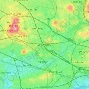
Name: Wembley topographic map, elevation, terrain.

Location: Wembley, Greater London, England, HA9 7BP, United Kingdom (51.51315 -0.33576 51.59315 -0.25576)

Average elevation: 44 m

Minimum elevation: 8 m

Maximum elevation: 120 m

England trails, hiking, mountain biking, running and outdoor activities

Gear up for your next adventure:

🪓Outdoor Multitools - Versatile tools for hiking and camping
🔋Solar Chargers - Eco-friendly charging solutions for outdoor use
🗺️Ordnance Survey Maps - Official UK maps for walking and outdoor activities
🚲Cycling GPS Computers - Track elevation and topographic routes on two wheels
📕Outdoor Navigation Books - Learn traditional and modern navigation techniques

As an Amazon Associate, this site earns from qualifying purchases at no extra cost to you.