
Make a donation
Gear up for your next adventure:
As an Amazon Associate, this site earns from qualifying purchases at no extra cost to you.
Beaufays topographic map
Click on the map to display elevation.
Make a donation
Gear up for your next adventure:
As an Amazon Associate, this site earns from qualifying purchases at no extra cost to you.
About this map
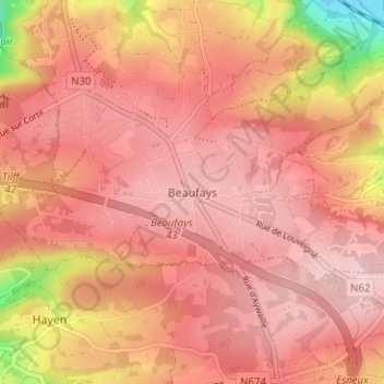
Name: Beaufays topographic map, elevation, terrain.
Location: Beaufays, Chaudfontaine, Liège, Wallonie, 4050, Belgique (50.53905 5.61857 50.57905 5.65857)
Average elevation: 242 m
Minimum elevation: 83 m
Maximum elevation: 301 m
Make a donation
Gear up for your next adventure:
As an Amazon Associate, this site earns from qualifying purchases at no extra cost to you.
Other topographic maps
Click on a map to view its topography, its elevation and its terrain.
Thier des Critchions
Belgique > Liège > Liège > Chaudfontaine > Vaux-sous-Chèvremont > Mehagne
Average elevation: 115 m
Make a donation
Gear up for your next adventure:
As an Amazon Associate, this site earns from qualifying purchases at no extra cost to you.