Geolocate

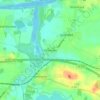
Fockbek topographic map

Click on the map to display elevation.

About this map

Name: Fockbek topographic map, elevation, terrain.

Location: Fockbek, Kreis Rendsburg-Eckernförde, Schleswig-Holstein, 24787, Germany (54.27697 9.54287 54.34419 9.62798)

Average elevation: 10 m

Minimum elevation: -3 m

Maximum elevation: 24 m

Other topographic maps

Click on a map to view its topography, its elevation and its terrain.

Gear up for your next adventure:

🧣Neck Gaiters - Versatile protection against wind and cold
🧥Breathable Waterproof Jackets - Essential rain protection for the unpredictable British climate
🥾Women's Waterproof Hiking Boots - High-performance trekking boots designed for all-weather comfort
🦯Walking Poles - Supportive poles for long-distance walking
👕Merino Base Layers - Natural temperature regulation for cold weather hiking and camping

As an Amazon Associate, this site earns from qualifying purchases at no extra cost to you.