
Thank you for supporting this site ❤️
Make a donation
Make a donation
Gear up for your next adventure:
As an Amazon Associate, this site earns from qualifying purchases at no extra cost to you.
Manuba topographic map
Click on the map to display elevation.
Thank you for supporting this site ❤️
Make a donation
Make a donation
Gear up for your next adventure:
As an Amazon Associate, this site earns from qualifying purchases at no extra cost to you.
About this map
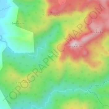
Name: Manuba topographic map, elevation, terrain.
Location: Manuba, Barru, South Sulawesi, Sulawesi, Indonesia (-4.23854 119.67376 -4.19854 119.71376)
Average elevation: 300 m
Minimum elevation: 14 m
Maximum elevation: 705 m
Thank you for supporting this site ❤️
Make a donation
Make a donation
Gear up for your next adventure:
As an Amazon Associate, this site earns from qualifying purchases at no extra cost to you.