
Wehringen topographic map
Interactive map
Click on the map to display elevation.
About this map
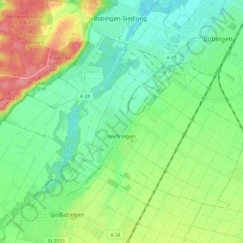
Name: Wehringen topographic map, elevation, terrain.
Location: Wehringen, Augsburg (district), Bavaria, 86517, Germany (48.22957 10.75970 48.26979 10.84384)
Average elevation: 533 m
Minimum elevation: 503 m
Maximum elevation: 586 m
Other topographic maps
Click on a map to view its topography, its elevation and its terrain.