Geolocate

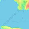
Stack Rock topographic map

Click on the map to display elevation.

About this map

Name: Stack Rock topographic map, elevation, terrain.

Location: Stack Rock, Angle, Pembrokeshire, Wales, United Kingdom (51.70224 -5.09263 51.70286 -5.09162)

Average elevation: 6 m

Minimum elevation: 0 m

Maximum elevation: 56 m

Other topographic maps

Click on a map to view its topography, its elevation and its terrain.
Stack Rock Fort

United Kingdom > Wales > Pembrokeshire > Angle

Average elevation: 6 m

Gear up for your next adventure:

📕Outdoor Navigation Books - Learn traditional and modern navigation techniques
🌂Windproof Trekking Umbrellas - Surprising but effective rain protection on low-wind trails
🥾Hiking Boots - Waterproof and durable boots for long-distance hiking in the UK
📻Hand-Crank Emergency Radios - Stay updated on weather warnings in remote areas
🔦Keychain LED Torches - Emergency backup light for finding gear in your pack

As an Amazon Associate, this site earns from qualifying purchases at no extra cost to you.