Geolocate

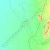
Kassala topographic map

Click on the map to display elevation.

About this map

Name: Kassala topographic map, elevation, terrain.

Location: Kassala, Kassala State, Sudan (15.29201 36.21707 15.61201 36.53707)

Average elevation: 512 m

Minimum elevation: 474 m

Maximum elevation: 1,196 m

Other topographic maps

Click on a map to view its topography, its elevation and its terrain.
Seteet District

Sudan > Kassala State

Average elevation: 448 m

Kassala

Sudan > Kassala State

Average elevation: 544 m

Al Gash

Sudan > Kassala State

Average elevation: 449 m

Kassala

Sudan > Kassala State

Average elevation: 544 m

Gear up for your next adventure:

📻Hand-Crank Emergency Radios - Stay updated on weather warnings in remote areas
🛰️Satellite Messengers - Emergency communication devices for areas without mobile signal
🛰️Outdoor GPS Navigation - Navigation devices for remote and off-grid areas
🧺Microfibre Travel Towels - Fast-drying and compact towels for wild swimming and camping
🎒Hiking Daypacks - Compact backpacks ideal for short hikes and excursions

As an Amazon Associate, this site earns from qualifying purchases at no extra cost to you.