Geolocate

Templeton topographic map

Click on the map to display elevation.

About this map
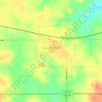
Name: Templeton topographic map, elevation, terrain.

Location: Templeton, Eden Township, Carroll County, Iowa, United States (41.91087 -94.94853 41.92445 -94.93466)

Average elevation: 434 m

Minimum elevation: 407 m

Maximum elevation: 455 m

Other topographic maps

Click on a map to view its topography, its elevation and its terrain.

Elk Run

United States > Iowa > Carroll County

Average elevation: 336 m

Gear up for your next adventure:

📱Rugged Phone Cases - Heavy-duty protection for smartphones used as secondary GPS tools
🗺️Ordnance Survey Maps - Essential paper maps for hiking across the UK national parks
🔦LED Camping Lanterns - Illumination for reading maps inside your tent at night
📦Dry Bags - Waterproof bags to protect gear from rain
🛌Sleeping Mats - Insulated mats for comfortable outdoor sleeping

As an Amazon Associate, this site earns from qualifying purchases at no extra cost to you.