Geolocate

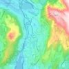
Storåsen topographic map

Click on the map to display elevation.

About this map

Name: Storåsen topographic map, elevation, terrain.

Location: Storåsen, Bergen, Vestland, 5115, Norway (60.46568 5.33537 60.46578 5.33547)

Average elevation: 127 m

Minimum elevation: 38 m

Maximum elevation: 345 m

Other topographic maps

Click on a map to view its topography, its elevation and its terrain.

Fana

Norway > Vestland > Bergen

Average elevation: 142 m

Sverresborg

Norway > Vestland > Bergen

Average elevation: 85 m

Årstad

Norway > Vestland > Bergen

Average elevation: 184 m

Bergenhus

Norway > Vestland > Bergen

Average elevation: 210 m

Gear up for your next adventure:

🧊Insulated Flasks - Keeps drinks hot or cold during hikes
🔥Reusable Hand Warmers - Maintain dexterity in your fingers for precise map handling
⛺Lightweight Solo Tents - Backpacking tents designed for wild camping in the UK highlands
🛰️Satellite Messengers - Emergency communication devices for areas without mobile signal
🎒Hiking Backpacks - Comfortable backpacks for day hikes and multi-day treks

As an Amazon Associate, this site earns from qualifying purchases at no extra cost to you.