Geolocate

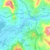
Vale topographic map

Click on the map to display elevation.

About this map

Name: Vale topographic map, elevation, terrain.

Location: Vale, Arcos de Valdevez, Viana do Castelo, Portugal (41.82741 -8.39260 41.86834 -8.32655)

Average elevation: 287 m

Minimum elevation: 40 m

Maximum elevation: 730 m

Other topographic maps

Click on a map to view its topography, its elevation and its terrain.

Moledo

Portugal > Viana do Castelo > Moledo e Cristelo

Average elevation: 98 m

Moledo

Portugal > Viana do Castelo > Moledo e Cristelo

Average elevation: 98 m

Venade

Portugal > Viana do Castelo > Caminha

Average elevation: 90 m

Vilar de Suente

Portugal > Viana do Castelo > Soajo

Average elevation: 473 m

Corredoura

Portugal > Viana do Castelo > Melgaço > Alvaredo

Average elevation: 185 m

Gear up for your next adventure:

📢Survival Whistles - Essential safety gear for signaling for help in mountain fog
📦Dry Bags - Waterproof bags to protect gear from rain
🎒Hiking Child Carriers - Explore the outdoors with the whole family safely
🧤Waterproof Overmitts - Extreme weather protection for hikers and mountaineers
🔥Emergency Fire Starters - Reliable ignition tools for survival situations in damp conditions

As an Amazon Associate, this site earns from qualifying purchases at no extra cost to you.