Tangkas topographic map
Interactive map
Click on the map to display elevation.
About this map

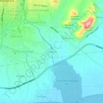
Name: Tangkas topographic map, elevation, terrain.
Location: Tangkas, Klungkung Regency, Bali, 80711, Indonesia (-8.57508 115.40220 -8.53508 115.44220)
Average elevation: 36 m
Minimum elevation: 0 m
Maximum elevation: 183 m
Other topographic maps
Click on a map to view its topography, its elevation and its terrain.

Penida Island
Indonesia > Bali > Klungkung Regency > Batukandik
Nusa Penida (Balinese: ᬦᬸᬲᬧᭂᬦᬶᬤ, romanized: nusa pĕnida) is an island located near the southeastern Indonesian island of Bali, which forms a district of the same name in Klungkung Regency. The Badung Strait separates the island and Bali. The interior of Nusa Penida is hilly with a maximum…
Average elevation: 104 m

Lembongan Island
Indonesia > Bali > Klungkung Regency > Jungutbatu > Jungut Batu
Average elevation: 13 m