Geolocate

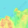
Spider Island topographic map

Click on the map to display elevation.

About this map

Name: Spider Island topographic map, elevation, terrain.

Location: Spider Island, Town of Liberty Grove, Door County, Wisconsin, United States (45.20650 -86.97857 45.21143 -86.97293)

Average elevation: 175 m

Minimum elevation: 172 m

Maximum elevation: 187 m

Other topographic maps

Click on a map to view its topography, its elevation and its terrain.
Gear up for your next adventure:

🎒Hiking Backpacks - Comfortable backpacks for day hikes and multi-day treks
💧Hydration Reservoirs - Convenient water bladders for hands-free drinking on the move
📻Hand-Crank Emergency Radios - Stay updated on weather warnings in remote areas
🧥Waterproof Hiking Jackets - Rain protection for walking in all weather conditions
📕Outdoor Navigation Books - Learn traditional and modern navigation techniques

As an Amazon Associate, this site earns from qualifying purchases at no extra cost to you.