Geolocate

SUDs topographic map

Click on the map to display elevation.

About this map

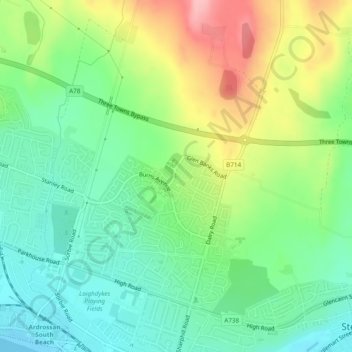
Name: SUDs topographic map, elevation, terrain.

Location: SUDs, Saltcoats, North Ayrshire, Scotland, United Kingdom (55.65189 -4.78288 55.65231 -4.78242)

Average elevation: 48 m

Minimum elevation: 0 m

Maximum elevation: 132 m

North Ayrshire trails, hiking, mountain biking, running and outdoor activities

Gear up for your next adventure:

🥾Walking Shoes - Lightweight walking shoes for countryside and coastal paths
🛌Sleeping Mats - Insulated mats for comfortable outdoor sleeping
Insulated Travel Mugs - Keep drinks hot while surveying the landscape from a summit
Lightweight Tents - Compact tents for backpacking and trekking
🗺️Ordnance Survey Maps - Essential paper maps for hiking across the UK national parks

As an Amazon Associate, this site earns from qualifying purchases at no extra cost to you.