Geolocate

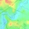
Patterdown topographic map

Click on the map to display elevation.

About this map

Name: Patterdown topographic map, elevation, terrain.

Location: Patterdown, Chippenham, Wiltshire, England, SN15 2NR, United Kingdom (51.42935 -2.15318 51.46935 -2.11318)

Average elevation: 65 m

Minimum elevation: 39 m

Maximum elevation: 109 m

Wiltshire trails, hiking, mountain biking, running and outdoor activities

Other topographic maps

Click on a map to view its topography, its elevation and its terrain.
Monkton Park

United Kingdom > England > Wiltshire > Chippenham

Average elevation: 59 m

Gear up for your next adventure:

🎒Hiking Daypacks (20L) - Compact backpacks for day trips and technical mountain ascents
🔦Outdoor Torches - Reliable torches for night navigation
👟Women's Trail Running Shoes - Agile footwear for fell running and technical trails
🧤Thermal Touchscreen Gloves - Stay warm while operating your GPS or smartphone camera
🔥Emergency Fire Starters - Reliable ignition tools for survival situations in damp conditions

As an Amazon Associate, this site earns from qualifying purchases at no extra cost to you.