Geolocate

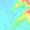
Topland topographic map

Click on the map to display elevation.

About this map

Name: Topland topographic map, elevation, terrain.

Location: Topland, Koronadal, South Cotabato, Soccsksargen, Philippines (6.47109 124.91065 6.50970 124.98171)

Average elevation: 147 m

Minimum elevation: 62 m

Maximum elevation: 488 m

Other topographic maps

Click on a map to view its topography, its elevation and its terrain.
Quezon Range

Philippines > South Cotabato > Koronadal

Average elevation: 239 m

Quezon Range

Philippines > South Cotabato > Koronadal

Average elevation: 239 m

Siok

Philippines > South Cotabato > Koronadal > Mabini

Average elevation: 131 m

Gear up for your next adventure:

❄️Walking Crampons - Added traction for icy slopes and winter peak bagging
🧢Thermal Beanie Hats - Prevent heat loss from the head in windy summit conditions
🧥Packable Down Jackets - Lightweight warmth that compresses small in your bag
🔋Lithium AA Batteries - Long-lasting power that performs well in cold mountain weather
🧘Folding Sit Mats - Dry and warm seat for map-reading breaks on damp ground

As an Amazon Associate, this site earns from qualifying purchases at no extra cost to you.