
Nyamaropa topographic map
Interactive map
Click on the map to display elevation.
About this map
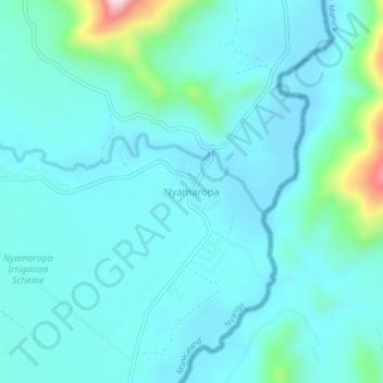
Name: Nyamaropa topographic map, elevation, terrain.
Location: Nyamaropa, Nyanga, Manicaland Province, Zimbabwe (-17.88097 32.93263 -17.84097 32.97263)
Average elevation: 870 m
Minimum elevation: 812 m
Maximum elevation: 1,225 m
Other topographic maps
Click on a map to view its topography, its elevation and its terrain.
Troutbeck
Zimbabwe > Manicaland Province > Nyanga
Troutbeck, Nyanga, Manicaland Province, Zimbabwe
Average elevation: 2,102 m