Geolocate

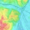
Pecherskyi district topographic map

Click on the map to display elevation.

About this map

Name: Pecherskyi district topographic map, elevation, terrain.

Location: Pecherskyi district, Kyiv, Ukraine (50.40255 30.51602 50.45504 30.59024)

Average elevation: 134 m

Minimum elevation: 87 m

Maximum elevation: 210 m

Other topographic maps

Click on a map to view its topography, its elevation and its terrain.
Kyiv

Ukraine > Kyiv

Average elevation: 131 m

Bald Mountain

Ukraine > Kyiv

Average elevation: 123 m

Bald Mountain

Ukraine > Kyiv

Average elevation: 123 m

Пронівщина

Ukraine > Kyiv

Average elevation: 174 m

Gear up for your next adventure:

🥤Hydration Bladders - Hands-free hydration systems for backpacks
🥤Collapsible Water Bottles - Save space in your rucksack as you consume your water
🧼Biodegradable Soap - Leave-no-trace hygiene for multi-day mountain treks
📕Outdoor Navigation Books - Learn traditional and modern navigation techniques
🦶Anti-Blister Balms - Protect your feet before long topographic expeditions

As an Amazon Associate, this site earns from qualifying purchases at no extra cost to you.