
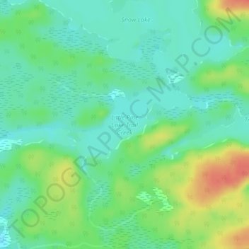
Little Pine Lake;Trail Creek topographic map
Interactive map
Click on the map to display elevation.
About this map
Name: Little Pine Lake;Trail Creek topographic map, elevation, terrain.
Average elevation: 402 m
Minimum elevation: 384 m
Maximum elevation: 435 m
Other topographic maps
Click on a map to view its topography, its elevation and its terrain.
Shan Walshe Lake
Canada > Ontario > Rainy River District > Unorganized Rainy River
Average elevation: 465 m