Geolocate

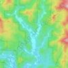
Hudson topographic map

Click on the map to display elevation.

About this map

Name: Hudson topographic map, elevation, terrain.

Location: Hudson, Caldwell County, North Carolina, 28638, United States (35.83131 -81.51589 35.86631 -81.45097)

Average elevation: 378 m

Minimum elevation: 339 m

Maximum elevation: 458 m

Other topographic maps

Click on a map to view its topography, its elevation and its terrain.
Upton

United States > North Carolina > Caldwell County

Average elevation: 536 m

Globe

United States > North Carolina > Caldwell County

Average elevation: 489 m

Piney

United States > North Carolina > Caldwell County

Average elevation: 377 m

Globe

United States > North Carolina > Caldwell County

Average elevation: 489 m

Warrior

United States > North Carolina > Caldwell County

Average elevation: 431 m

Gear up for your next adventure:

🐕Hiking Dog Harnesses - Rugged harnesses for taking your companion on mountain trails
🧢Hiking Hats - Sun and weather protection for outdoor walks
🍱Food Containers - Reusable containers for outdoor meals
🥾Hiking Boot Waterproofing Wax - Maintain the lifespan of your leather trekking boots
🩹Hiking First Aid Kits - Compact medical kits tailored for trail injuries and emergencies

As an Amazon Associate, this site earns from qualifying purchases at no extra cost to you.