
Au (SG) topographic map
Interactive map
Click on the map to display elevation.
About this map
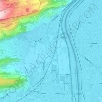
Name: Au (SG) topographic map, elevation, terrain.
Location: Au (SG), Wahlkreis Rheintal, St. Gallen, Schweiz (47.40567 9.61933 47.44383 9.65105)
Average elevation: 441 m
Minimum elevation: 398 m
Maximum elevation: 739 m
Other topographic maps
Click on a map to view its topography, its elevation and its terrain.
Montlingen
Schweiz > St. Gallen > Wahlkreis Rheintal
Montlingen, Oberriet, Wahlkreis Rheintal, St. Gallen, 9462, Schweiz
Average elevation: 427 m
Oberriet
Schweiz > St. Gallen > Wahlkreis Rheintal
Oberriet, Wahlkreis Rheintal, St. Gallen, Schweiz
Average elevation: 528 m