Geolocate

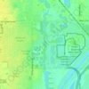
Goddard topographic map

Click on the map to display elevation.

Goddard

Goddard is located at 37°39′35″N 97°34′27″W / 37.65972°N 97.57417°W / 37.65972; -97.57417 (37.659706, -97.574271) at an elevation of 1,463 feet (446 m). Goddard lies on U.S. Route 54 in south-central Kansas, immediately west of Wichita.

Wikipedia (CC-BY-SA 3.0)

About this map

Name: Goddard topographic map, elevation, terrain.

Location: Goddard, Sedgwick County, Kansas, United States (37.64312 -97.59830 37.68582 -97.53479)

Average elevation: 443 m

Minimum elevation: 429 m

Maximum elevation: 455 m

Other topographic maps

Click on a map to view its topography, its elevation and its terrain.
Murray Gill

United States > Kansas > Sedgwick County

Average elevation: 395 m

County Acres

United States > Kansas > Sedgwick County > Wichita

Average elevation: 407 m

Furley

United States > Kansas > Sedgwick County

Average elevation: 426 m

Sand Burr Hill

United States > Kansas > Sedgwick County > Wichita

Average elevation: 385 m

Midland Park

United States > Kansas > Sedgwick County > Wichita

Average elevation: 387 m

The Hawthorne

United States > Kansas > Sedgwick County > Wichita

Average elevation: 418 m

Gear up for your next adventure:

🥤Collapsible Water Bottles - Save space in your rucksack as you consume your water
🧤Thermal Touchscreen Gloves - Stay warm while operating your GPS or smartphone camera
📸Action Camera Chest Mounts - Record your ascent following topographic paths hands-free
🔥Reusable Hand Warmers - Maintain dexterity in your fingers for precise map handling
📱Phone Mounts for Hiking - Secure mounts to carry your phone on trails

As an Amazon Associate, this site earns from qualifying purchases at no extra cost to you.