
Nowthen topographic map
Interactive map
Click on the map to display elevation.
About this map
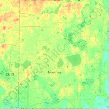
Name: Nowthen topographic map, elevation, terrain.
Location: Nowthen, Anoka County, Minnesota, United States (45.29889 -93.51099 45.38552 -93.38839)
Average elevation: 284 m
Minimum elevation: 265 m
Maximum elevation: 305 m
Other topographic maps
Click on a map to view its topography, its elevation and its terrain.
Blaine
United States > Minnesota > Anoka County
Blaine, Anoka County, Minnesota, United States
Average elevation: 274 m
Rum River
United States > Minnesota > Anoka County > Anoka
Rum River, Anoka, Anoka County, Minnesota, United States
Average elevation: 265 m
Columbia Heights
United States > Minnesota > Anoka County
Columbia Heights, Anoka County, Minnesota, 55421, United States
Average elevation: 282 m
Andover
United States > Minnesota > Anoka County
Andover, Anoka County, Minnesota, 55304, United States
Average elevation: 273 m