Geolocate

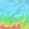
Laguerta topographic map

Click on the map to display elevation.

About this map
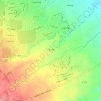
Name: Laguerta topographic map, elevation, terrain.

Location: Laguerta, Calamba, Laguna, Calabarzon, 4027, Philippines (14.16276 121.07416 14.18215 121.10073)

Average elevation: 193 m

Minimum elevation: 138 m

Maximum elevation: 242 m

Other topographic maps

Click on a map to view its topography, its elevation and its terrain.
Bucal

Philippines > Laguna > Calamba

Average elevation: 22 m

88 Spa & Resort

Philippines > Laguna > Calamba

Average elevation: 83 m

ASN Ph2 Park

Philippines > Laguna > Calamba

Average elevation: 133 m

Bucal Reservoir

Philippines > Laguna > Calamba

Average elevation: 42 m

Calamba Town Plaza

Philippines > Laguna > Calamba

Average elevation: 11 m

Casa de Palmera Resort

Philippines > Laguna > Calamba

Average elevation: 49 m

Gear up for your next adventure:

🌄Compact Monoculars - Lightweight optics for hiking
⛺Lightweight Tents - Compact tents for backpacking and trekking
🧢Hiking Hats - Sun and weather protection for outdoor walks
🎿Telescopic Trekking Poles - Reduces knee strain on steep topographic descents
🎒Hiking Child Carriers - Explore the outdoors with the whole family safely

As an Amazon Associate, this site earns from qualifying purchases at no extra cost to you.