
Ανάβυσσος topographic map
Interactive map
Click on the map to display elevation.
About this map
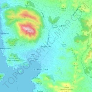
Name: Ανάβυσσος topographic map, elevation, terrain.
Average elevation: 91 m
Minimum elevation: -8 m
Maximum elevation: 479 m
Other topographic maps
Click on a map to view its topography, its elevation and its terrain.
Astypalaia
Greece > Attica > Regional Unit of East Attica > Anavissos Municipal Unit
Average elevation: 10 m