
Awasi topographic map
Interactive map
Click on the map to display elevation.
About this map
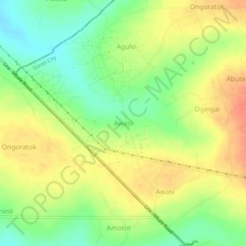
Name: Awasi topographic map, elevation, terrain.
Location: Awasi, Soroti City, Eastern Region, Uganda (1.74433 33.54964 1.78433 33.58964)
Average elevation: 1,079 m
Minimum elevation: 1,054 m
Maximum elevation: 1,102 m