
茹龙镇 topographic map
Interactive map
Click on the map to display elevation.
About this map
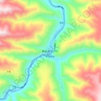
Name: 茹龙镇 topographic map, elevation, terrain.
Location: 茹龙镇, 新龙县, 甘孜藏族自治州, 四川省, 中国 (30.90121 100.27095 30.98121 100.35095)
Average elevation: 3,600 m
Minimum elevation: 3,024 m
Maximum elevation: 4,388 m
Other topographic maps
Click on a map to view its topography, its elevation and its terrain.