Geolocate

Varana topographic map

Click on the map to display elevation.

About this map

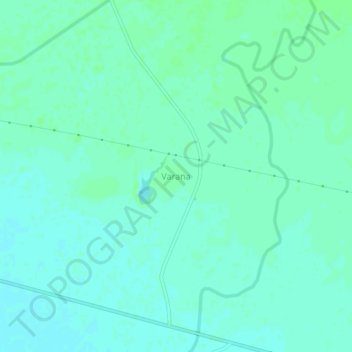
Name: Varana topographic map, elevation, terrain.

Location: Varana, Sami Taluka, Patan District, Gujarat, India (23.70757 71.70672 23.74757 71.74672)

Average elevation: 32 m

Minimum elevation: 28 m

Maximum elevation: 35 m

Gear up for your next adventure:

🥾Hiking Boots - Waterproof and durable boots for long-distance hiking in the UK
🔋Power Banks - Portable chargers for long outdoor trips
🧢Hiking Hats - Sun and weather protection for outdoor walks
🔦Keychain LED Torches - Emergency backup light for finding gear in your pack
📻Hand-Crank Emergency Radios - Stay updated on weather warnings in remote areas

As an Amazon Associate, this site earns from qualifying purchases at no extra cost to you.