Geolocate

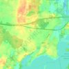
Hasselrade topographic map

Click on the map to display elevation.

About this map

Name: Hasselrade topographic map, elevation, terrain.

Location: Hasselrade, Felde, Amt Achterwehr, Kreis Rendsburg-Eckernförde, Schleswig-Holstein, 24242, Deutschland (54.28635 9.91447 54.32635 9.95447)

Average elevation: 17 m

Minimum elevation: -3 m

Maximum elevation: 38 m

Other topographic maps

Click on a map to view its topography, its elevation and its terrain.
Gear up for your next adventure:

📷Outdoor Action Cameras - Cameras designed for hiking and adventure
🧣Neck Gaiters - Versatile protection against wind and cold
🔋Solar Power Banks - Keep your GPS and phone charged during multi-day expeditions
🗺️Ordnance Survey Maps - Essential paper maps for hiking across the UK national parks
🧭Professional Hiking Compasses - High-precision liquid-filled compasses for map reading and orientation

As an Amazon Associate, this site earns from qualifying purchases at no extra cost to you.