Geolocate

Spry topographic map

Click on the map to display elevation.

About this map
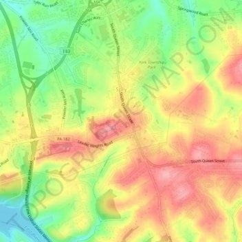
Name: Spry topographic map, elevation, terrain.

Location: Spry, York Township, York County, Pennsylvania, United States (39.89371 -76.70479 39.93280 -76.66180)

Average elevation: 206 m

Minimum elevation: 146 m

Maximum elevation: 257 m

Other topographic maps

Click on a map to view its topography, its elevation and its terrain.
Arbor

United States > Pennsylvania > York County > York Township

Average elevation: 244 m

Gear up for your next adventure:

🧦Hiking Socks - Breathable socks designed to prevent blisters on long walks
🥫Expedition Meals - Lightweight, high-calorie nutrition for long-distance hikers
⛺Lightweight Tents - Compact tents for backpacking and trekking
☕Insulated Travel Mugs - Keep drinks hot while surveying the landscape from a summit
🧭Orienteering Compasses - Accurate compasses for map-based navigation

As an Amazon Associate, this site earns from qualifying purchases at no extra cost to you.