Geolocate

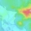
Sanguem topographic map

Click on the map to display elevation.

Sanguem

Sanguem is located at 15°14′N 74°10′E / 15.23°N 74.17°E / 15.23; 74.17. It has an average elevation of 22 metres (72 feet).

Wikipedia (CC-BY-SA 3.0)

About this map

Name: Sanguem topographic map, elevation, terrain.

Location: Sanguem, Kushavati, Goa, 403704, India (15.18827 74.11127 15.26827 74.19127)

Average elevation: 42 m

Minimum elevation: 2 m

Maximum elevation: 240 m

Other topographic maps

Click on a map to view its topography, its elevation and its terrain.
Salaulim Dam

India > Goa > Sanguem > Sanguem

Average elevation: 39 m

Maulinguem

India > Goa > Sanguem

Average elevation: 101 m

Sanvordem

India > Goa > Sanguem

Average elevation: 28 m

Gear up for your next adventure:

🧦Hiking Socks - Breathable socks designed to prevent blisters on long walks
🍳Camping Stoves - Compact stoves for outdoor cooking
📻Hand-Crank Emergency Radios - Stay updated on weather warnings in remote areas
📕Outdoor Navigation Books - Learn traditional and modern navigation techniques
🧊Personal Water Filters - Drink safely from mountain streams marked on your map

As an Amazon Associate, this site earns from qualifying purchases at no extra cost to you.