Geolocate

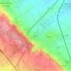
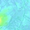
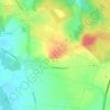
Sachin topographic map

Click on the map to display elevation.

About this map

Name: Sachin topographic map, elevation, terrain.

Location: Sachin, Arras, Pas-de-Calais, Hauts-de-France, Metropolitan France, 62550, France (50.47733 2.34289 50.50893 2.39064)

Average elevation: 148 m

Minimum elevation: 84 m

Maximum elevation: 192 m

Other topographic maps

Click on a map to view its topography, its elevation and its terrain.

Panehem

France > Hauts-de-France > Pas-de-Calais > Samer

Average elevation: 70 m

Le Petit Vimy

France > Hauts-de-France > Pas-de-Calais > Vimy

Average elevation: 93 m

Noyelles

France > Hauts-de-France > Pas-de-Calais > Bours

Average elevation: 125 m

Gear up for your next adventure:

🧣Fleece Neck Warmers - Extra insulation for winter topographic surveys
🔦Waterproof LED Headlamps - Hands-free lighting for evening treks and emergency navigation
🧷Tenacious Repair Tape - Instant fix for torn tents, jackets, or dry bags
🧺Ultralight Dry Bags - Organize and waterproof your gear inside your rucksack
🔋Power Banks - Portable chargers for long outdoor trips

As an Amazon Associate, this site earns from qualifying purchases at no extra cost to you.