Geolocate

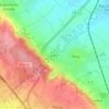
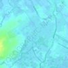
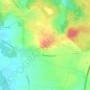
Ledinghem topographic map

Click on the map to display elevation.

About this map

Name: Ledinghem topographic map, elevation, terrain.

Location: Ledinghem, Saint-Omer, Pas-de-Calais, Hauts-de-France, Metropolitan France, 62380, France (50.63054 1.93721 50.66122 2.00738)

Average elevation: 161 m

Minimum elevation: 92 m

Maximum elevation: 205 m

Other topographic maps

Click on a map to view its topography, its elevation and its terrain.

Panehem

France > Hauts-de-France > Pas-de-Calais > Samer

Average elevation: 70 m

Le Petit Vimy

France > Hauts-de-France > Pas-de-Calais > Vimy

Average elevation: 93 m

Noyelles

France > Hauts-de-France > Pas-de-Calais > Bours

Average elevation: 125 m

Gear up for your next adventure:

🔥Emergency Fire Starters - Reliable ignition tools for survival situations in damp conditions
🧴Tick Removal Tools - Small, essential health tool for UK woodland and moorland
🧥Softshell Jackets - Breathable jackets for active outdoor use
🛰️Handheld GPS Devices - Reliable GPS units for hiking and outdoor navigation
🧼Biodegradable Soap - Leave-no-trace hygiene for multi-day mountain treks

As an Amazon Associate, this site earns from qualifying purchases at no extra cost to you.