Geolocate

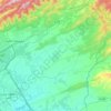
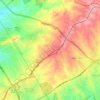
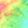
Mal Pur topographic map

Click on the map to display elevation.

About this map

Name: Mal Pur topographic map, elevation, terrain.

Location: Mal Pur, Zone III, Islamabad Capital Territory, 46500, Pakistan (33.70841 73.12578 33.74841 73.16578)

Average elevation: 565 m

Minimum elevation: 523 m

Maximum elevation: 633 m

Other topographic maps

Click on a map to view its topography, its elevation and its terrain.

Simly

Pakistan > Islamabad Capital Territory > Tijal

Average elevation: 745 m

Zone IV

Pakistan > Islamabad Capital Territory

Average elevation: 647 m

I-16

Pakistan > Islamabad Capital Territory

Average elevation: 522 m

Zone IV

Pakistan > Islamabad Capital Territory

Average elevation: 647 m

Zone 2

Pakistan > Islamabad Capital Territory

Average elevation: 558 m

Zone V

Pakistan > Islamabad Capital Territory

Average elevation: 522 m

Zone 1

Pakistan > Islamabad Capital Territory

Average elevation: 599 m

Zone III

Pakistan > Islamabad Capital Territory

Average elevation: 659 m

Gear up for your next adventure:

📸Action Camera Chest Mounts - Record your ascent following topographic paths hands-free
📕Outdoor Navigation Books - Learn traditional and modern navigation techniques
🔋Rechargeable Batteries - Eco-friendly power for headlamps and older GPS units
🧷Tenacious Repair Tape - Instant fix for torn tents, jackets, or dry bags
🧺Mesh Stuff Sacks - Breathable storage for wet gear or camp organization

As an Amazon Associate, this site earns from qualifying purchases at no extra cost to you.