
Thank you for supporting this site ❤️
Make a donation
Make a donation
Gear up for your next adventure:
As an Amazon Associate, this site earns from qualifying purchases at no extra cost to you.
Miombo topographic map
Click on the map to display elevation.
Thank you for supporting this site ❤️
Make a donation
Make a donation
Gear up for your next adventure:
As an Amazon Associate, this site earns from qualifying purchases at no extra cost to you.
About this map
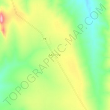
Name: Miombo topographic map, elevation, terrain.
Location: Miombo, Nkasi, Rukwa Region, Southern Highlands Zone, Tanzania (-7.49893 31.16888 -7.45893 31.20888)
Average elevation: 1,647 m
Minimum elevation: 1,559 m
Maximum elevation: 1,765 m
Thank you for supporting this site ❤️
Make a donation
Make a donation
Gear up for your next adventure:
As an Amazon Associate, this site earns from qualifying purchases at no extra cost to you.
Other topographic maps
Click on a map to view its topography, its elevation and its terrain.