
Guranda topographic map
Interactive map
Click on the map to display elevation.
About this map
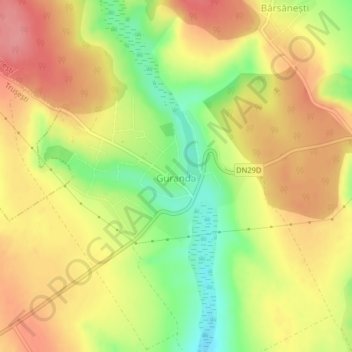
Name: Guranda topographic map, elevation, terrain.
Location: Guranda, Botoșani, 717151, Rumanía (47.76912 27.05940 47.78233 27.08103)
Average elevation: 188 m
Minimum elevation: 137 m
Maximum elevation: 227 m